State Maps Home > State Map Collection > Vermont Map
Printable Map of Vermont
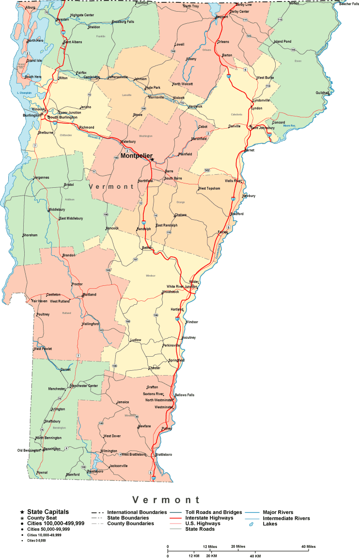
The above is a plain depiction presenting the geography of this environs with a plain selection of map components.
Of course, you can download this image and work with it in your projects. Citing this page would be our request.
If you are hoping for help getting a map, a different kind of map, or are hoping for a nice custom cartographic design, please do not hesitate to email us.
Order proper customized maps from us. A custom map made by us embrace a full array of elements, e.g.: thoroughfares, scale bar, coordinates, caves, conservation areas, sea features, craters, or rivers, etc. Types of maps reach from historical to satellite, digital to hardcopy, national to urban growth areas.
Nice maps are explicit, current, and not unclear. Detail-Oriented map-making by YellowMaps.
To procure printed maps or charts, such as backroad mapbooks, country maps, or maps for kayaking, please visit our online map shop You can find tens of thousands map products.
Ask us about our free shipping offer.
Back to State map collection